WINTER WEATHER STORM ALERT!!!
From Friday 1-23-26 to Sunday 1-25-26.
What to Expect
High confidence for a regional winter storm Friday night into the weekend followed by very cold temperatures.
Some uncertainties on exact details such as timing, precipitation type, and amounts.
Very cold temperatures expected to continue into early next week.
How the Forecast Could Change
Forecast Uncertainties
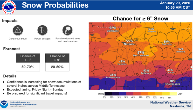
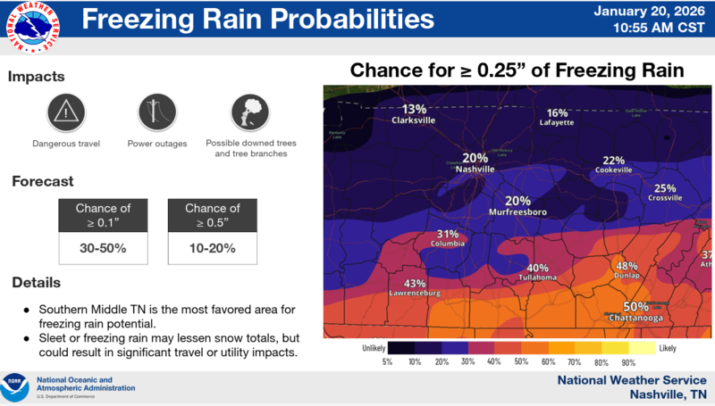
Precipitation Type: The depth of the cold air will have an impact on precipitation type, especially across southern Middle TN
Amounts: The track of the storm system as well as if any sleet or freezing rain occurs will impact snow amounts
Timing: While light snow may begin Friday, the bulk of accumulating snow looks to be Saturday and into Sunday morning
What To Do Now
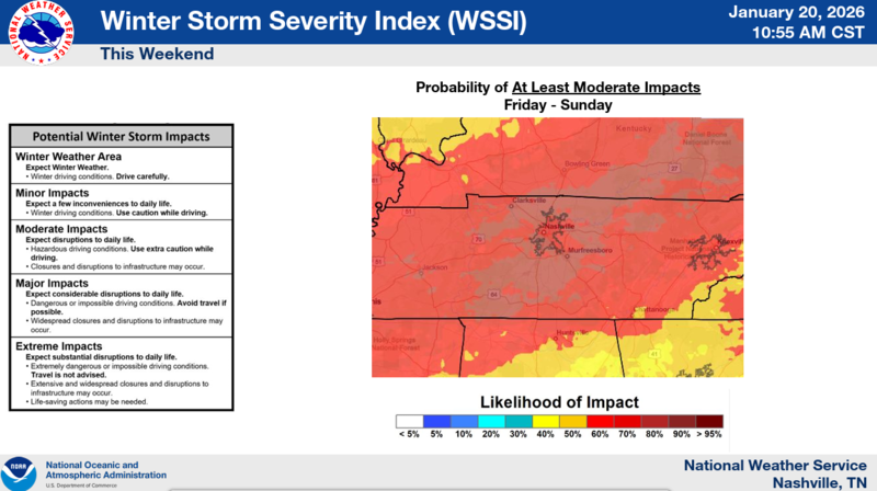
Specific details are still uncertain, but forecaster confidence is high for winter weather impacts this weekend.
Be prepared for significant travel impacts as well as a prolonged period of sub-freezing temperatures.
In Summary
High confidence in a winter storm impacting Middle Tennessee this weekend.
While details regarding amounts are still being worked out, significant travel impacts are possible this weekend, as well as power outages.
Very cold temperatures expected to persist into early next week, perhaps staying below freezing until Wednesday.
As always you can find the latest National Weather Service Situation Report (updated twice daily) https://www.weather.gov/media/ohx/briefing/SitRep.pdf
You can find more information regarding winter weather preparedness at: https://www.ready.gov/winter-weather#prepare